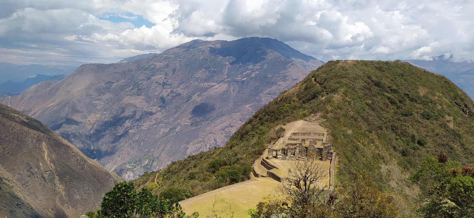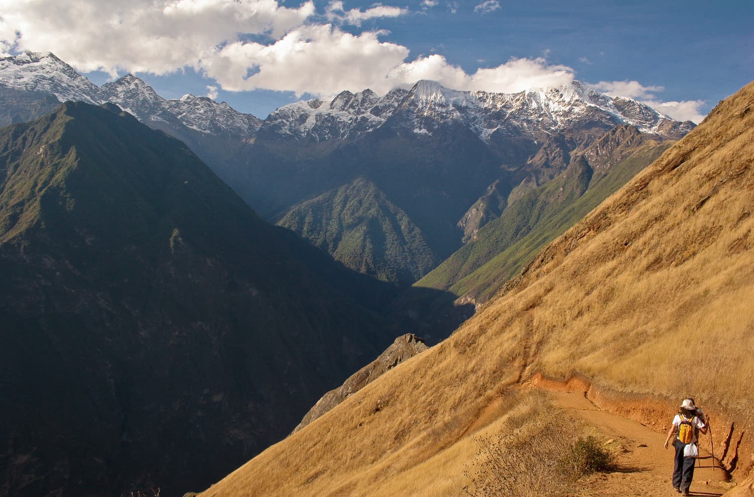
The classic Choquequirao trek is an out-and-back walk from Capuliyoc, above the village of Cachora, down into the Apurímac canyon and up the far side to the ruins — roughly 30 km each way and around 3,000 m of ascent over the whole trip. It is usually done in four days (about a morning at the site) or five days (a whole day at the site, which we strongly recommend).
The route at a glance
Distances and altitudes are approximate and vary between sources and GPS devices; use them for planning, not as gospel.
| Point | Altitude (approx.) | From previous (approx.) | What is there |
|---|---|---|---|
| Cachora | 2,900 m | — | Village, lodges, mules and arrieros |
| Capuliyoc | 2,900 m | 10 km by road | Trailhead, viewpoint, campsite |
| Chiquisca | 1,900 m | ≈8 km, mostly downhill | Campsite, water, small shop |
| Playa Rosalina | 1,550 m | ≈2 km, steep downhill | Bridge over the Apurímac, campsite |
| Santa Rosa | 2,100 m | ≈2.5 km, steep uphill | Family campsites, cold drinks |
| Marampata | 2,900 m | ≈3.5 km, steep uphill | Hamlet, campsites, first view of the ruins |
| Choquequirao | 3,050 m | ≈3 km, gentle | Control point, campsite, the ruins |
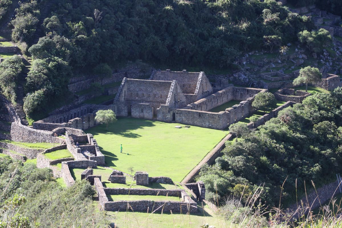 Choquequirao archaeological park
 Choquequirao
The Inca “cradle of gold”
A late-Inca royal estate and ceremonial centre spread along a ridge at about 3,050 m, 1,500 m above the Apurímac river. Plazas, fountains, a flattened ceremonial summit and terraces spilling down the mountain — and only a handful of visitors a day.
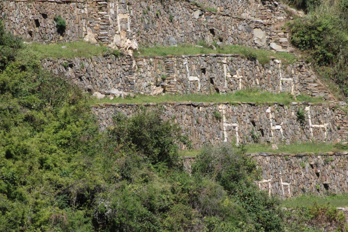 Choquequirao archaeological park
 The Llama Terraces
Inca art in white stone
On Choquequirao’s western flank, a flight of steep terraces is decorated with more than twenty llamas picked out in white stone against the dark walls — a mosaic unique in the Inca world, uncovered in the early 2000s.
 The trail & the Apurímac
 Apurímac Canyon
The “great speaker” river
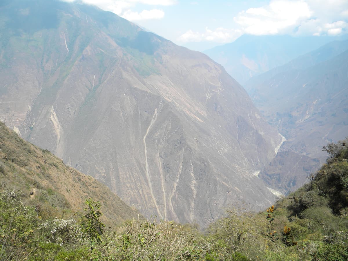
The trek to Choquequirao crosses one of the deepest canyons in the Americas. From the rim at Capuliyoc the trail drops some 1,400 m to the thundering Apurímac at Playa Rosalina, then climbs the far wall to the ruins.
 The trail & the Apurímac
 Cachora & Capuliyoc
The trailhead village
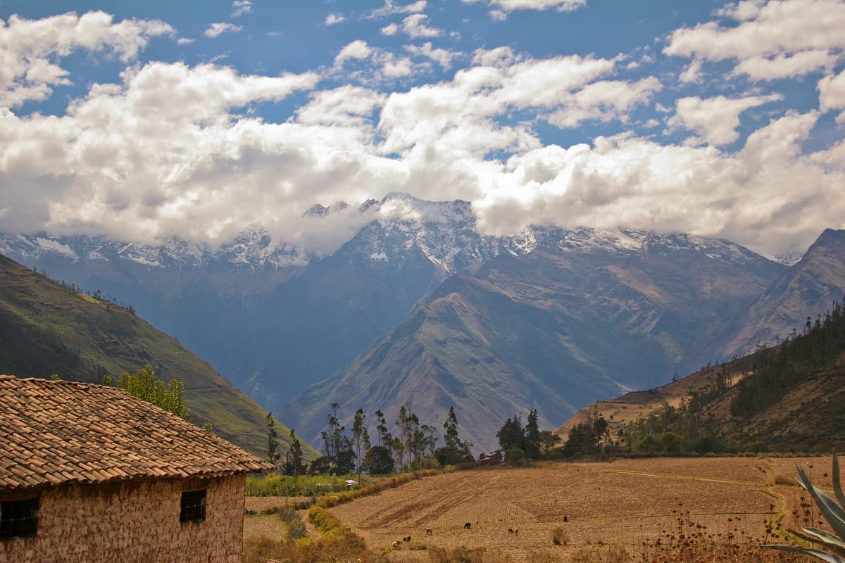
A quiet farming village at about 2,900 m facing the snowy Padreyoc peak, where mules are loaded and arrieros hired. Ten kilometres on, the Capuliyoc viewpoint marks the start of the trail and the first gasp-inducing view into the canyon.
The classic 4-day itinerary
Day 1 — Cusco to Capuliyoc, down to Chiquisca or Playa Rosalina
A pre-dawn start from Cusco and about four hours on the road to Cachora, where the mules are loaded. From the Capuliyoc viewpoint the trail zigzags down the dry, exposed canyon wall for three to five hours. Most groups camp at Chiquisca; stronger groups continue to the river at Playa Rosalina to shorten the next day.
Day 2 — The big climb to Marampata and Choquequirao
Cross the Apurímac on the bridge and start the climb that defines the trek: roughly 1,300–1,500 m of ascent via Santa Rosa to Marampata, on a steep, sun-baked path. Start at first light. From Marampata the ruins appear across the valley, and the last hour to the campsite below the site is nearly level.
Day 3 — Choquequirao, then back down
Explore the main sectors in the morning — the plazas, the ceremonial platform, the water channels and, if your legs allow, the llama terraces — then descend to Santa Rosa or Playa Rosalina for the night.
Day 4 — Out of the canyon to Capuliyoc and back to Cusco
The last test: the long climb from the river back up to Capuliyoc, then the drive to Cusco, usually arriving in the evening.
Why five days is better
The five-day version adds a full day at Choquequirao. That matters, because the site is enormous: the llama terraces alone are a steep walk below the main plaza, and the Paraqtepata terraces, the upper sector and the ceremonial platform each deserve time. It also splits the climbs into more humane stages. If you can spare it, take the fifth day. See the best 5-day treks.
Choquequirao to Machu Picchu (8–9 days)
From Choquequirao a much wilder route continues north across the Vilcabamba range: past the Pinchaunuyoc terraces, down to the Río Blanco, up to Maizal, over a pass above 4,000 m near old Spanish mine workings, through Yanama, and on via Totora or Llactapata to the Hidroeléctrica station and Aguas Calientes for Machu Picchu. It takes eight or nine days, crosses several high passes and is best done with an experienced outfitter. It is one of the finest long walks in the Cusco region — see the 8-day trek on our tours page.
Guided or independent?
- Organised trek: transport, guide, cook, mules, tents, meals and usually the ticket. You carry a daypack. The easiest way and, for most people, the best value.
- Independent: perfectly possible — the trail is obvious and there are campsites with water and basic shops on the way. Hire a mule and arriero in Cachora, carry cash for everything and bring a water filter.
- Hybrid: many trekkers go independently but with a muleteer from Cachora, which removes most of the pain for a modest daily fee.
What to pack
- Broken-in boots and trekking poles — your knees will thank you on the descents.
- Sun hat, high-factor sunscreen and sunglasses: the canyon has almost no shade.
- Strong insect repellent — small biting flies are fierce around the river.
- A warm layer and a sleeping bag for around 0 °C: nights near the ruins are cold.
- Water treatment (filter or tablets) and at least two litres of capacity.
- Enough Peruvian soles in cash for the whole trek; there are no card machines on the trail.
- A headtorch, a rain jacket (even in the dry season) and blister care.